Weather & map overlays Premium
Lay a weather forecast — or public land — right over your route, and scrub through the days ahead to see what you’re driving into. Overlays are a premium feature.
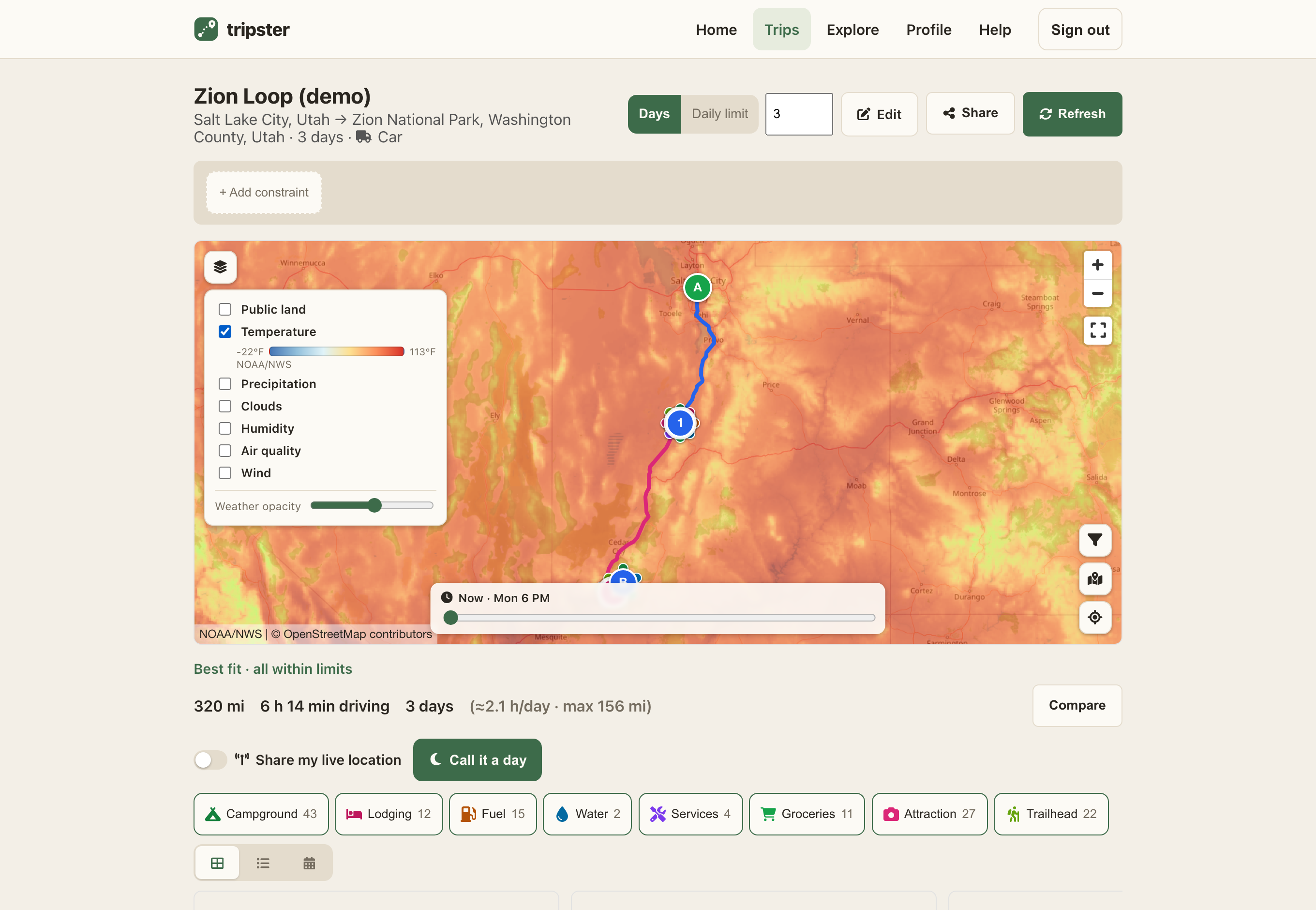
Turn on an overlay
- Open a trip to see its route on the map.
- Tap Map layers in the map corner to open the layers panel.
- Tick any overlay to draw it over the route. Each one shows a legend so you can read the colours; turn on as many as you like.
- Drag the Weather opacity slider if the colours hide the road and city names — it fades the overlay without turning it off, and remembers your setting.
What you can overlay
- Temperature
- Air temperature, in your °F/°C preference. Handy for the overnight-cold check.
- Precipitation
- Where rain (or snow) is falling and how heavy.
- Humidity & clouds
- Relative humidity and cloud cover across the map.
- Wind
- Arrows showing wind direction and speed — bigger and denser as you zoom in. Useful for a high-profile rig on an exposed stretch.
- Air quality
- Surface fine-particle (PM2.5) levels — good for spotting wildfire smoke.
- Public land
- BLM and other public land, for finding free, legal places to camp. Pairs well with My Places.
Scrub the forecast in time
With a weather overlay on, a time slider appears under the map. Drag it to step through the forecast hours, and a marker travels along your route to show where you’ll be at that time — so you can line up the weather with the leg you’ll actually be driving.